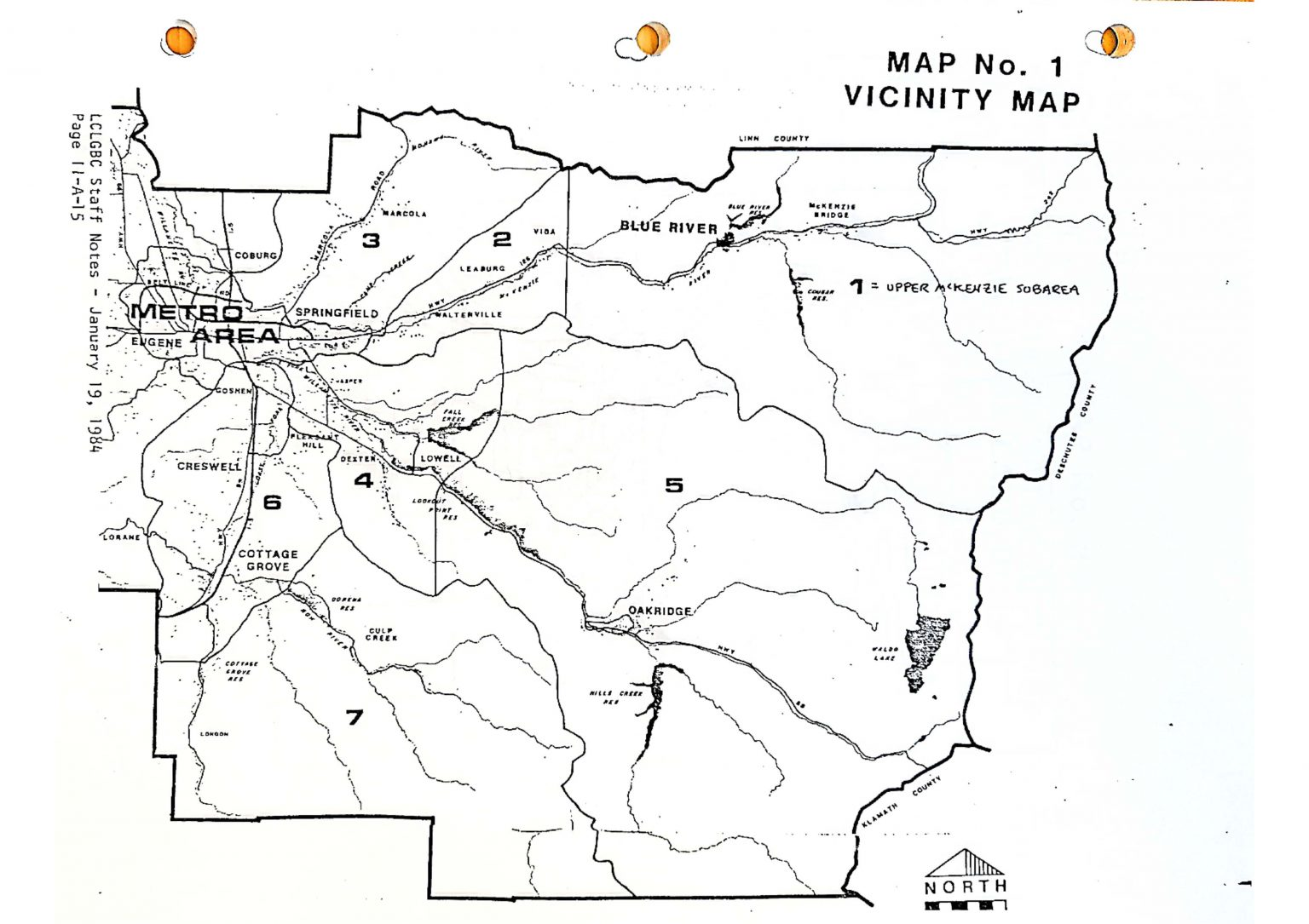
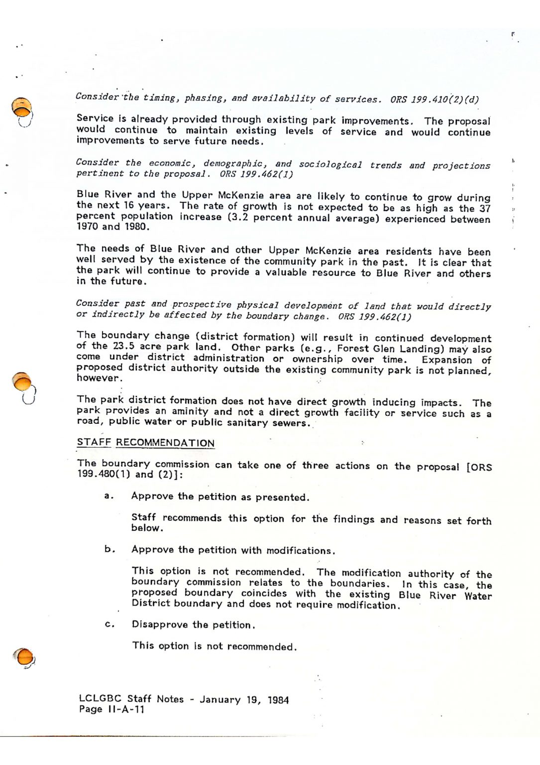
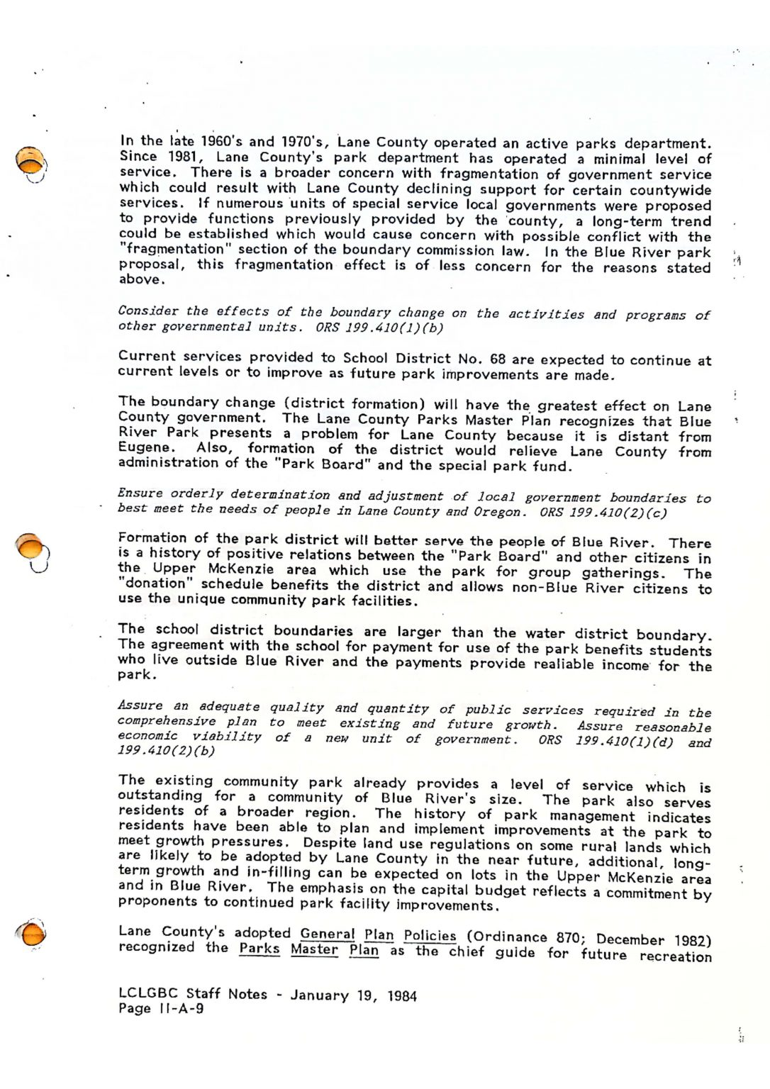
History
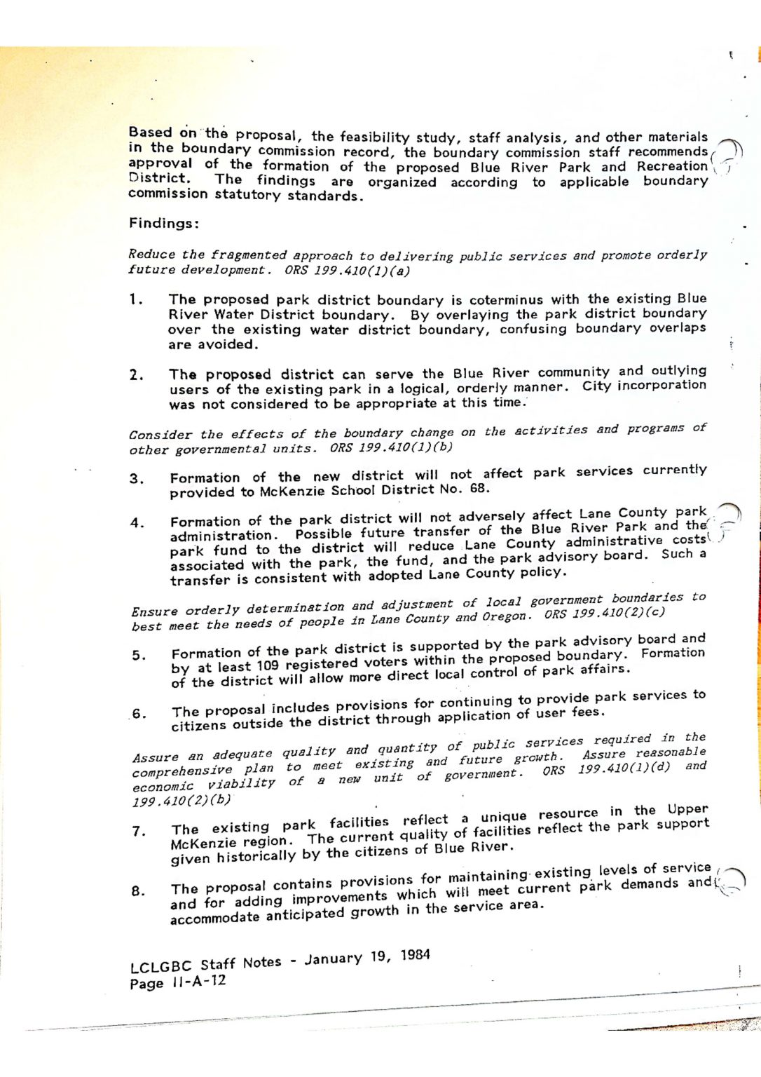
About the Behms
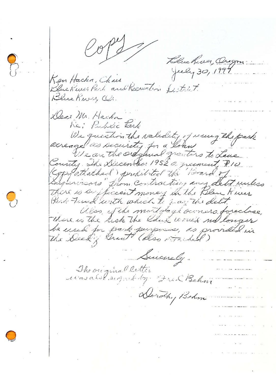
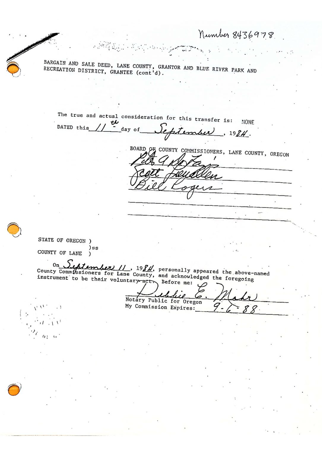
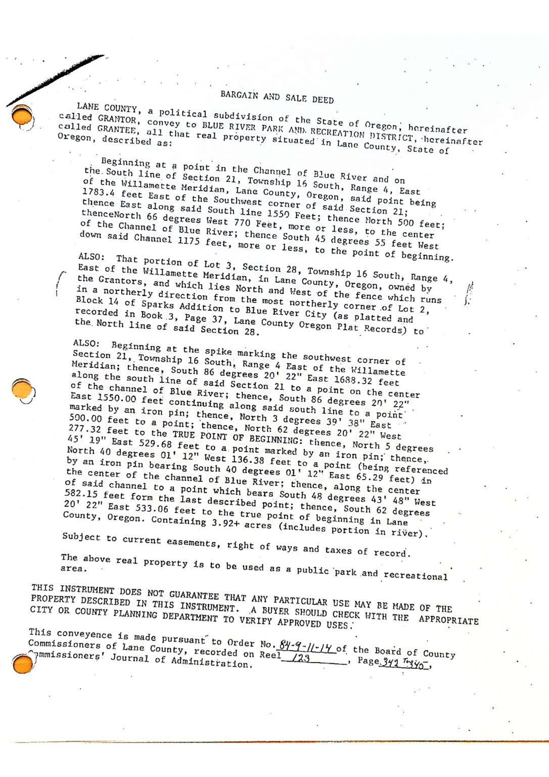
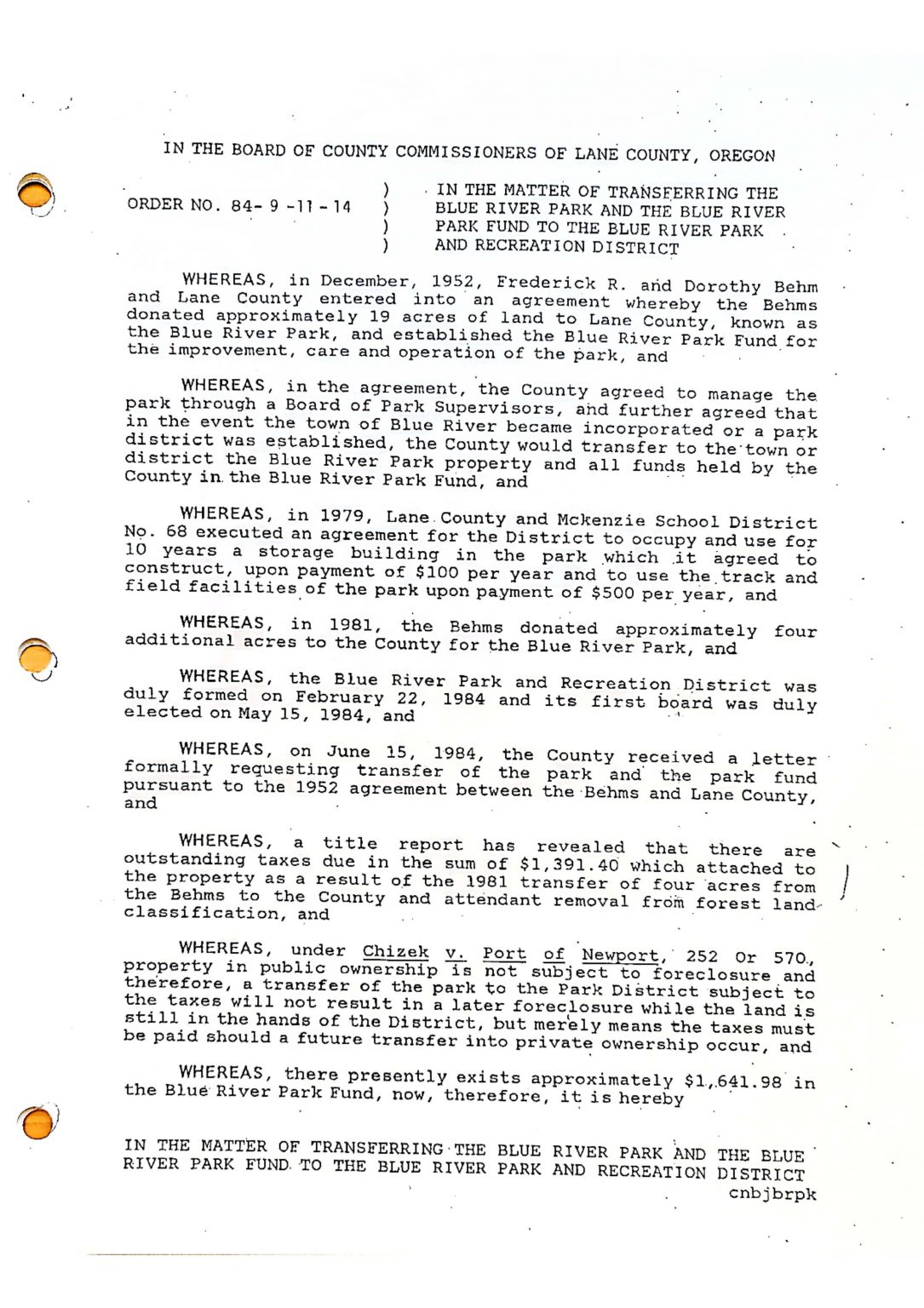
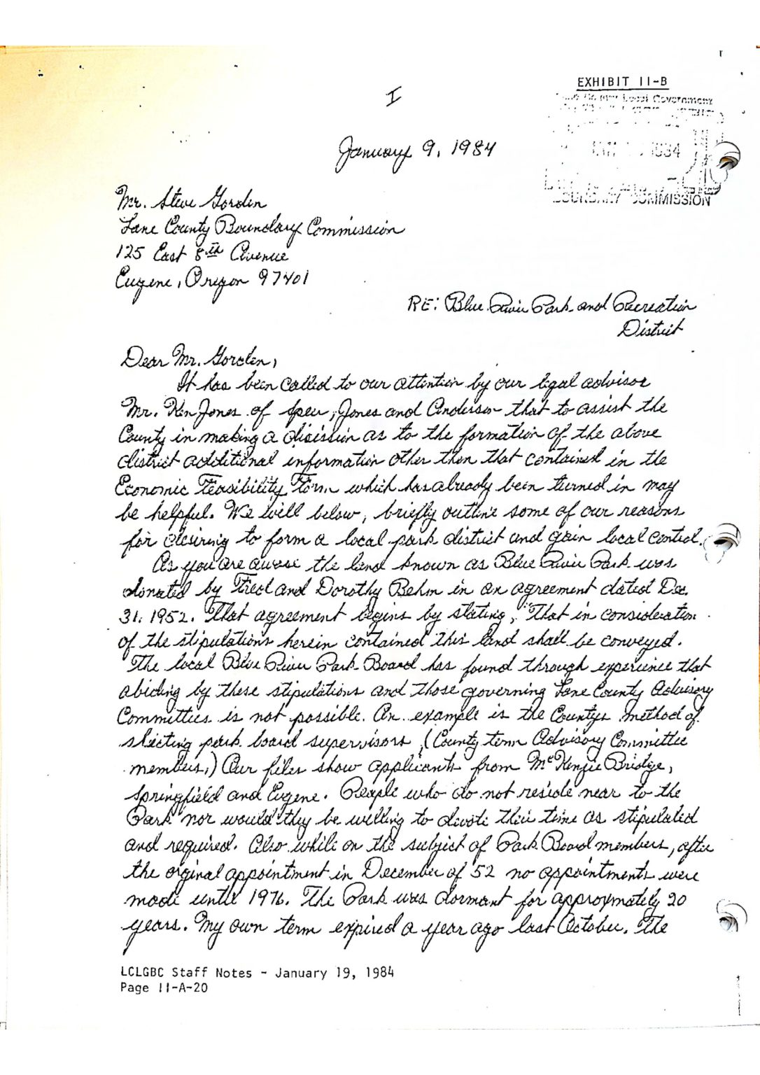
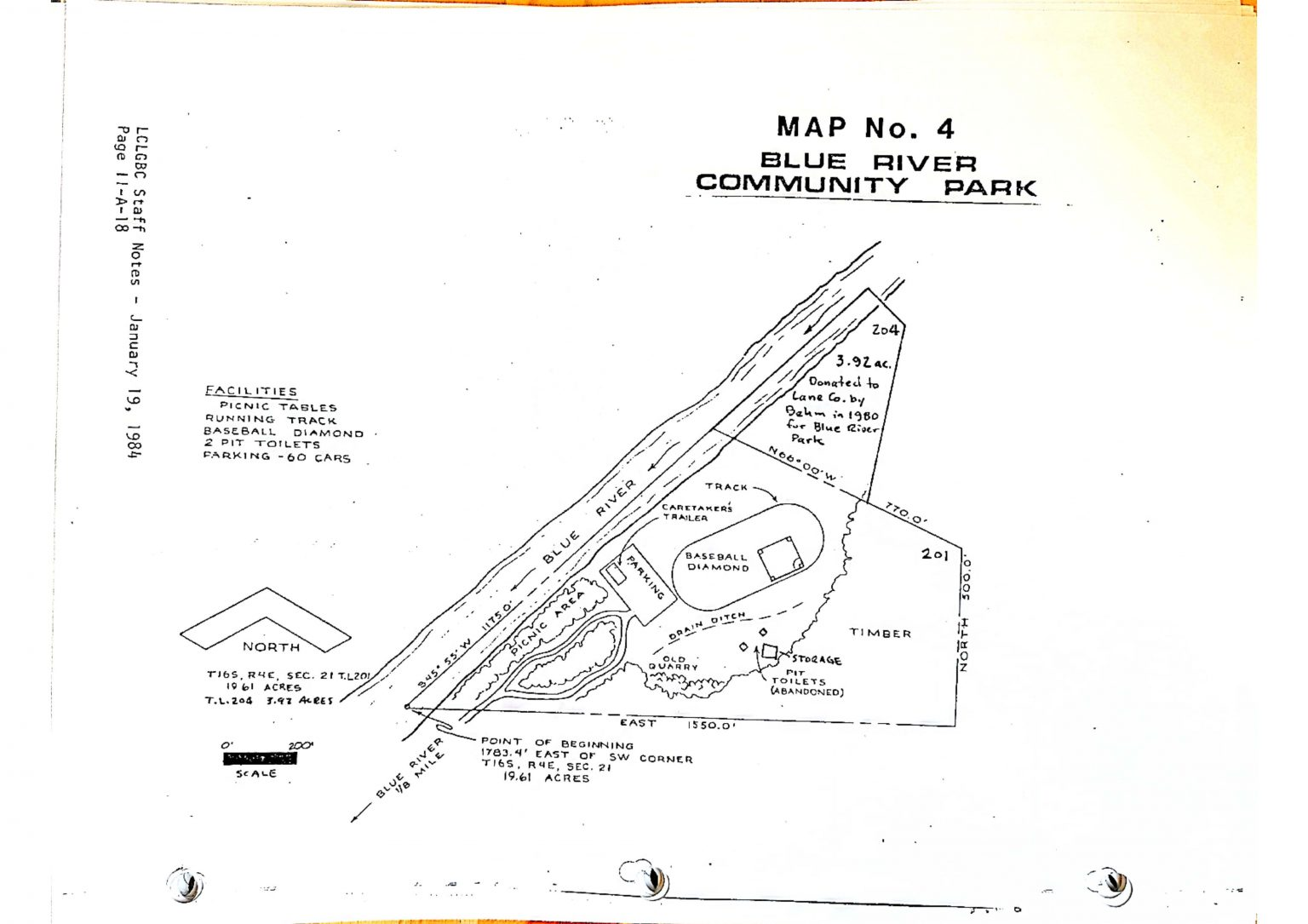
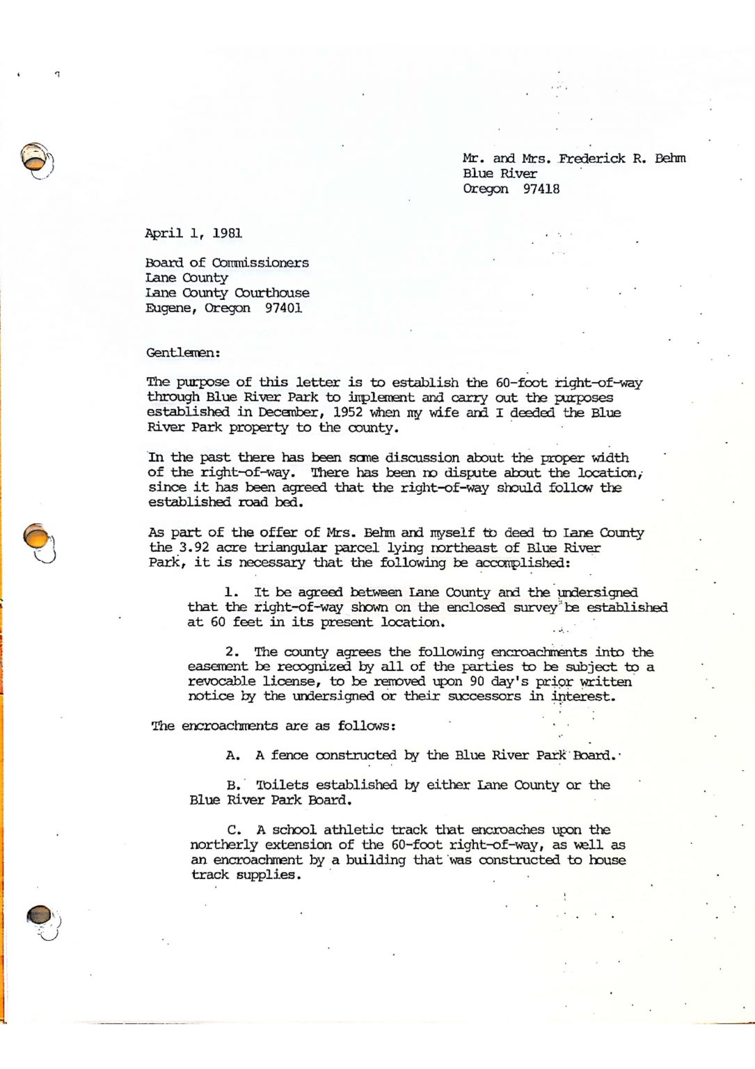
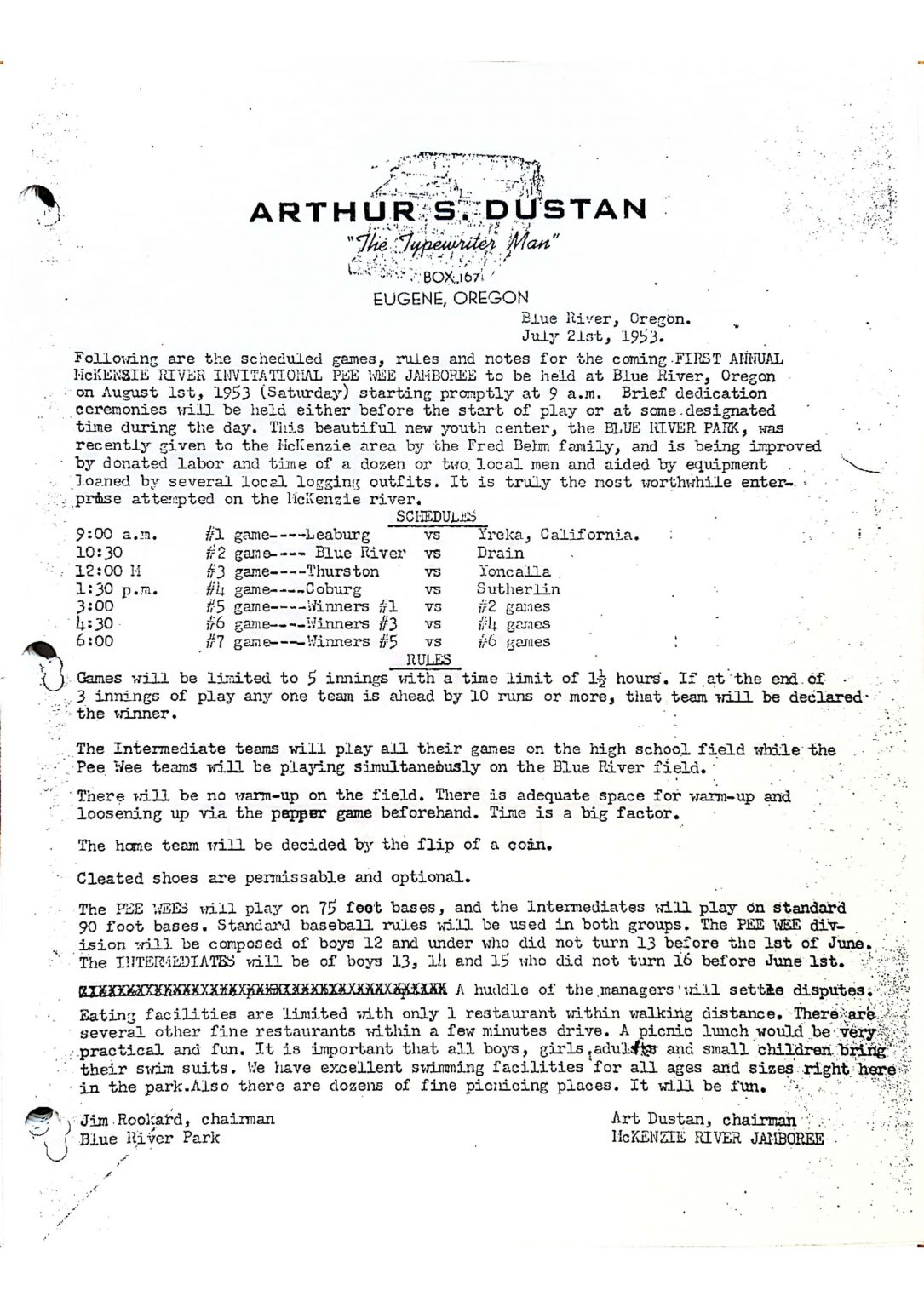
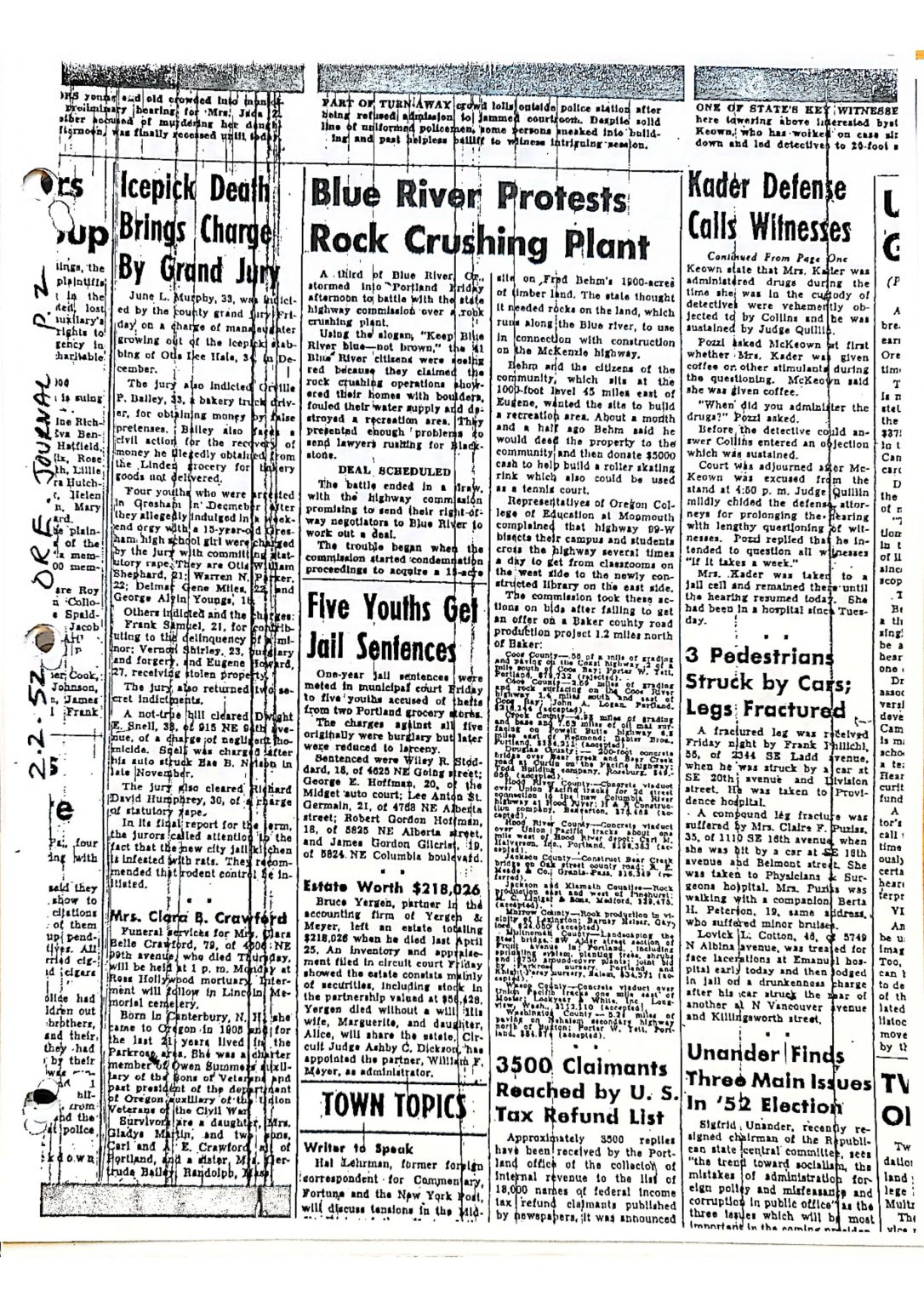
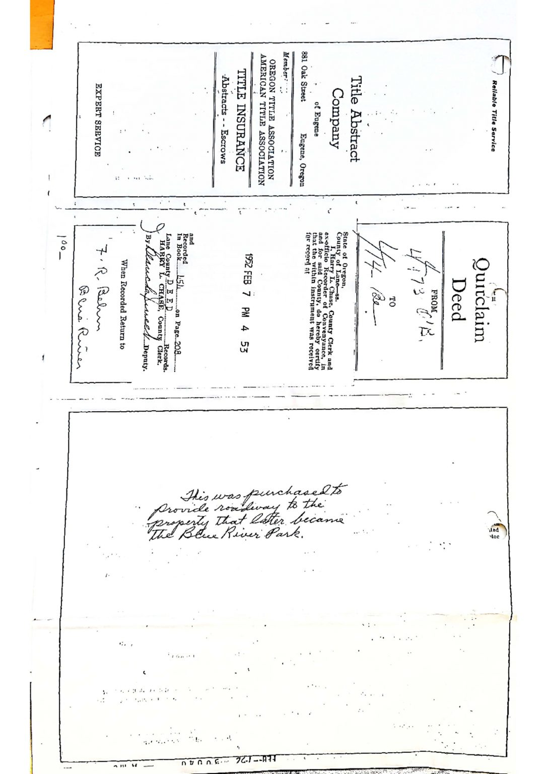
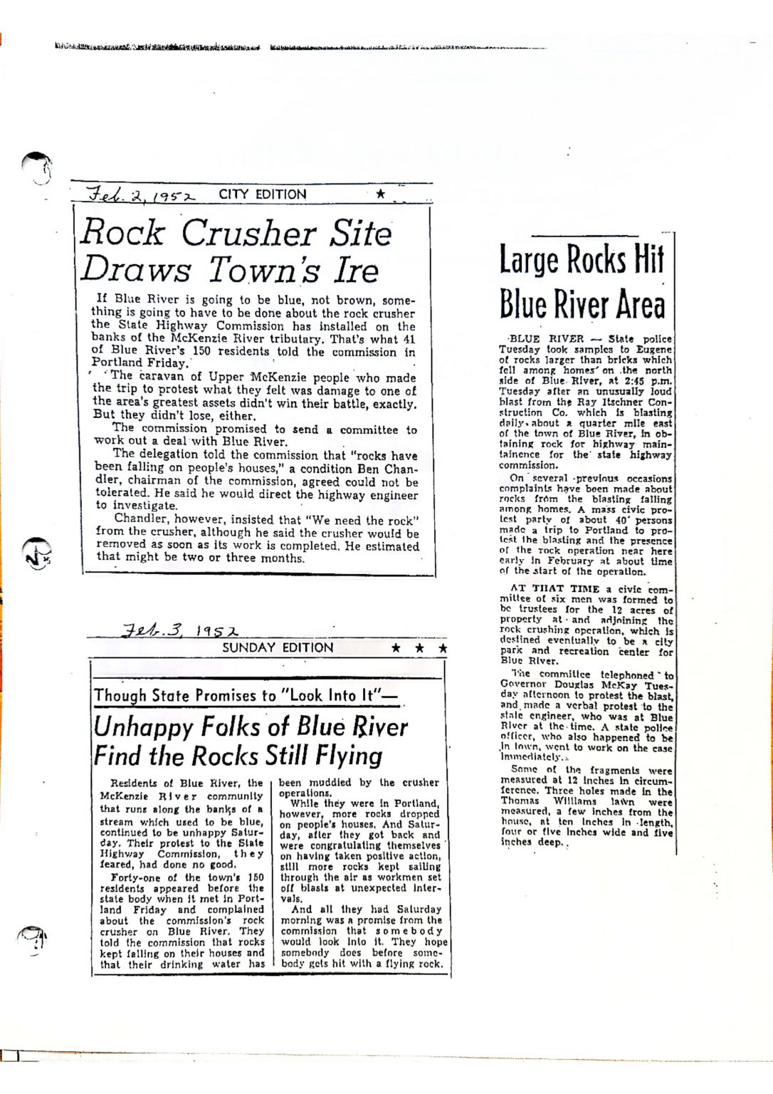
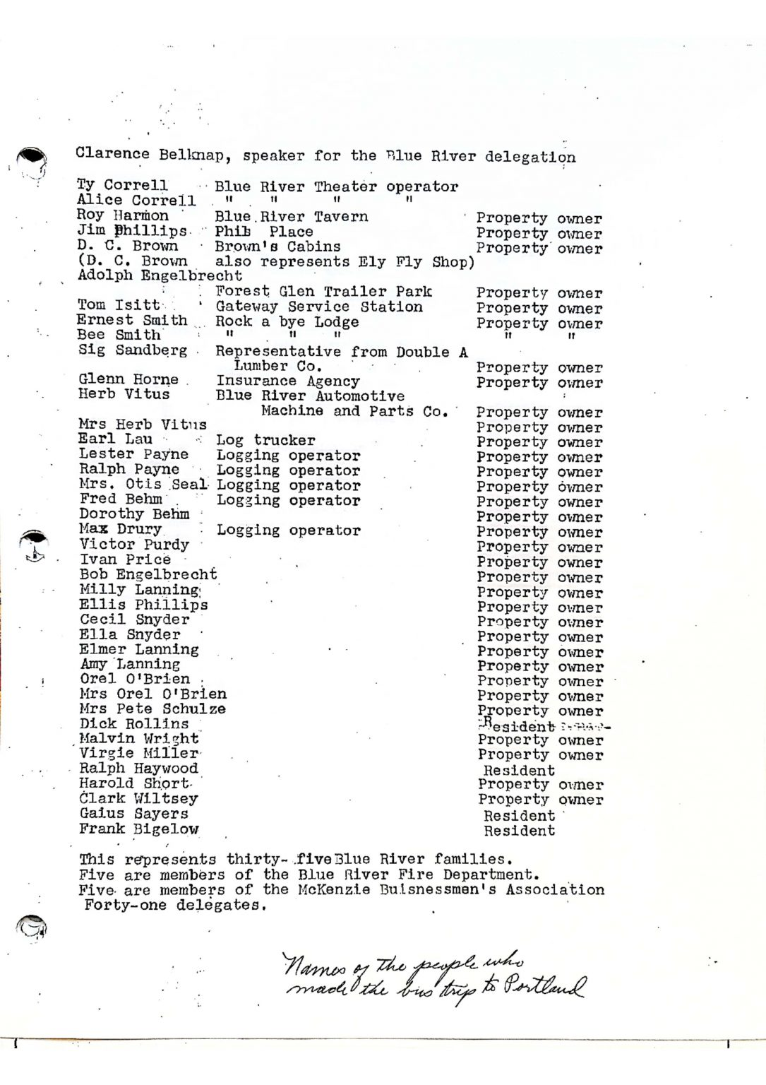
Fred and Dorothy Behm moved to the community of Blue River in 1941. Fred was a logger and tree farmer and he and Dorothy acquired timberland in the area. They actively supported causes that benefited the community and in 1952 made a gift of this property to the community for use as a park.
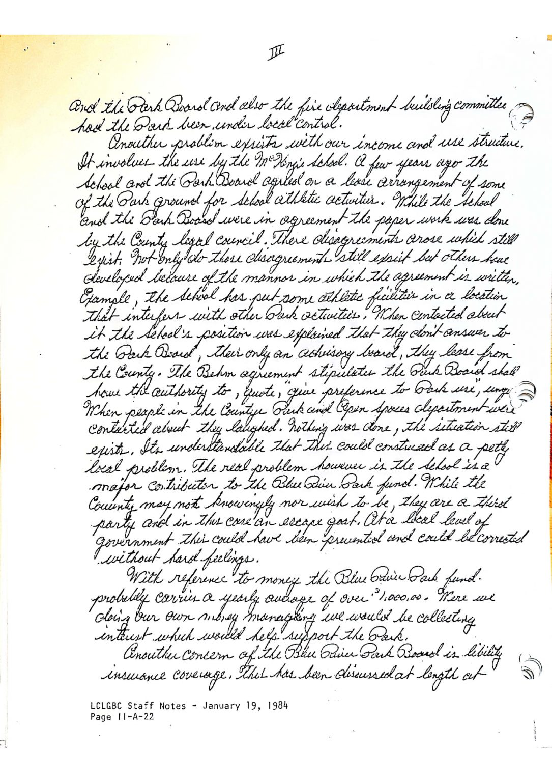
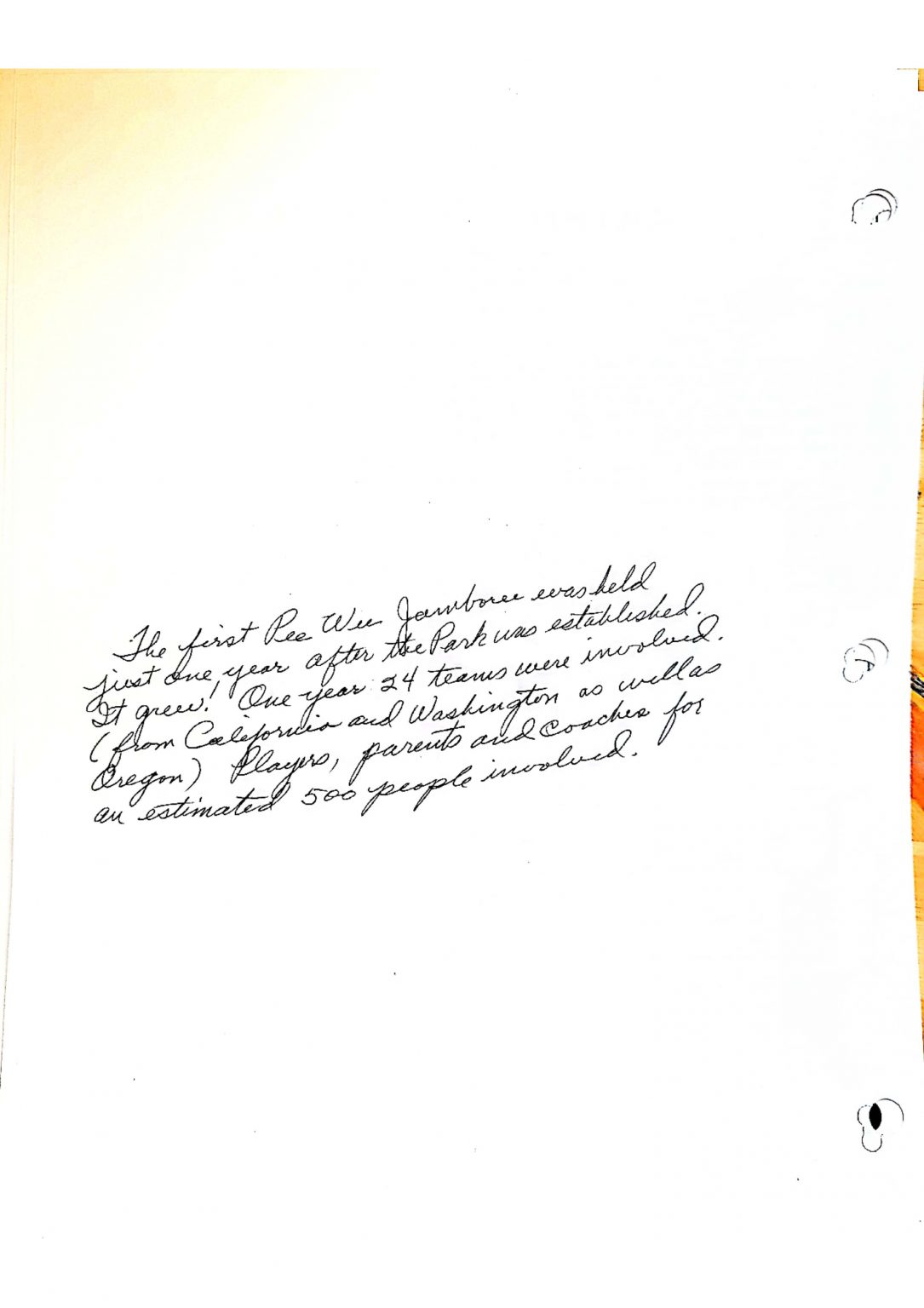
All of the improvements and maintenance have been accomplished by volunteers and sustained by donations. Oversight has continuously been provided by a local board of directors. All sorts of events have taken place here including little league and community baseball, high school track, fundraising “turkey shoots” just before the fall hunting season, outdoor concerts, “trunk or treat” at Halloween, community gardening, “slab dances” and a host of other activities.
The Future
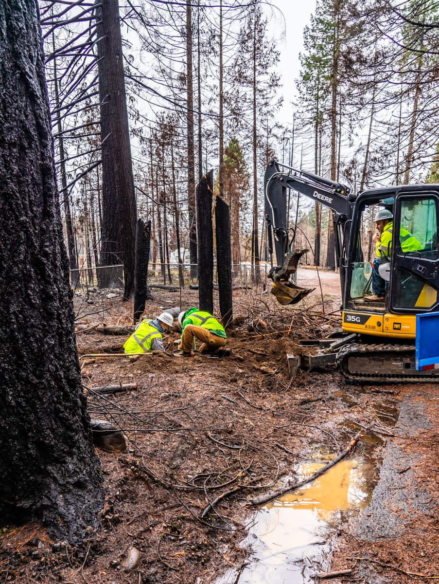
On the night of Labor Day, 2020, the Blue River Park, along with most of the surrounding town, was devastated by the Holiday Farm Fire. But with great challenges come great opportunities. As we approach our 70th anniversary, the Blue River Park District wants to build back better than ever before, once again becoming a favorite place for locals and visitors to experience the beauty and joy of the McKenzie River Valley. Join us in our journey by donating, volunteering, or getting in touch with ideas and suggestions.
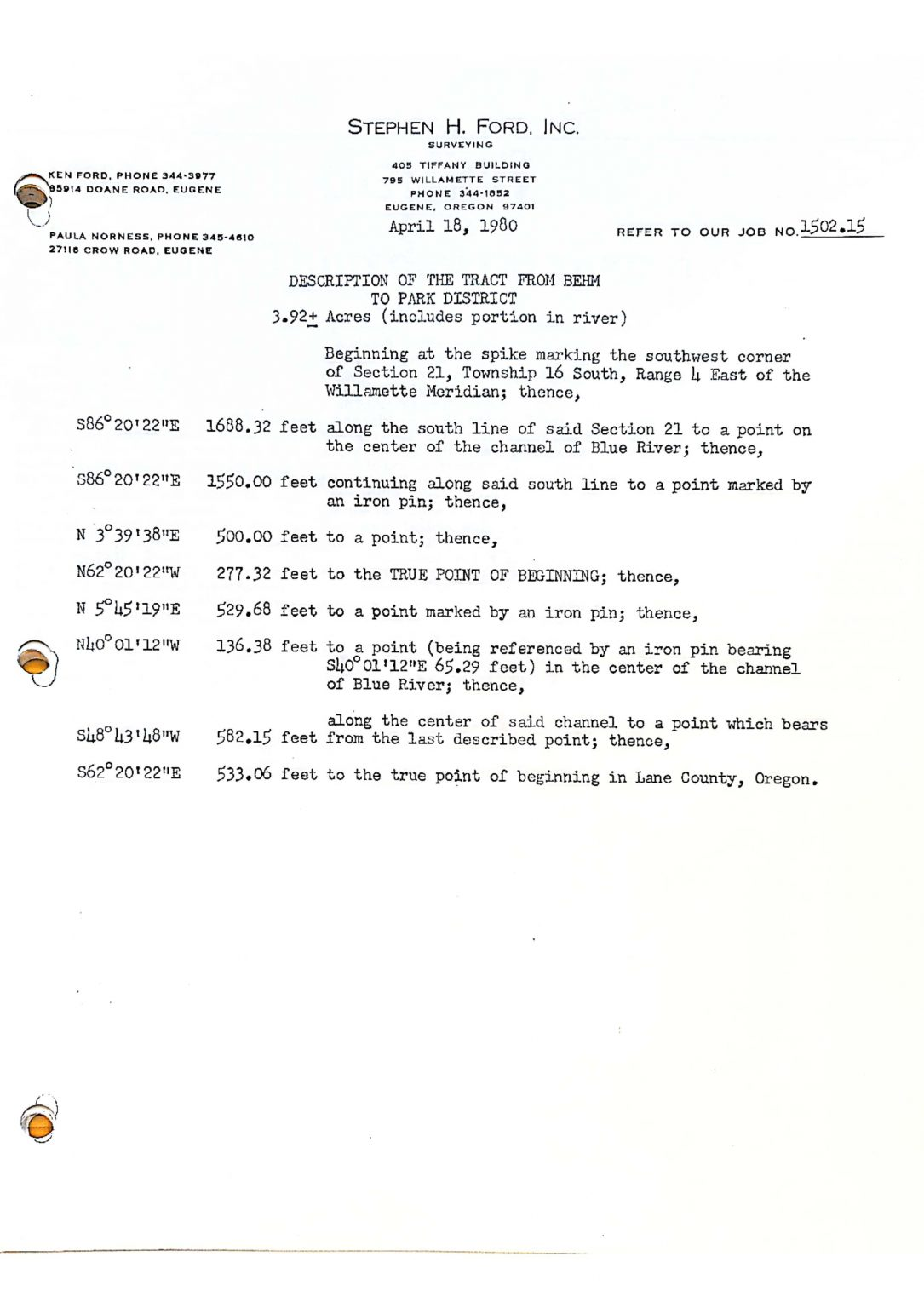
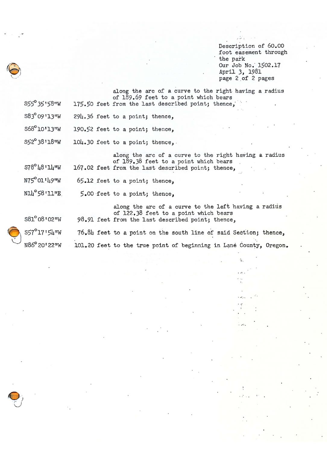
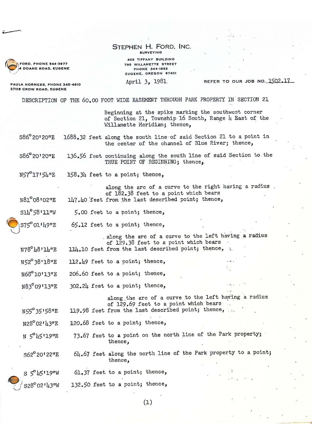
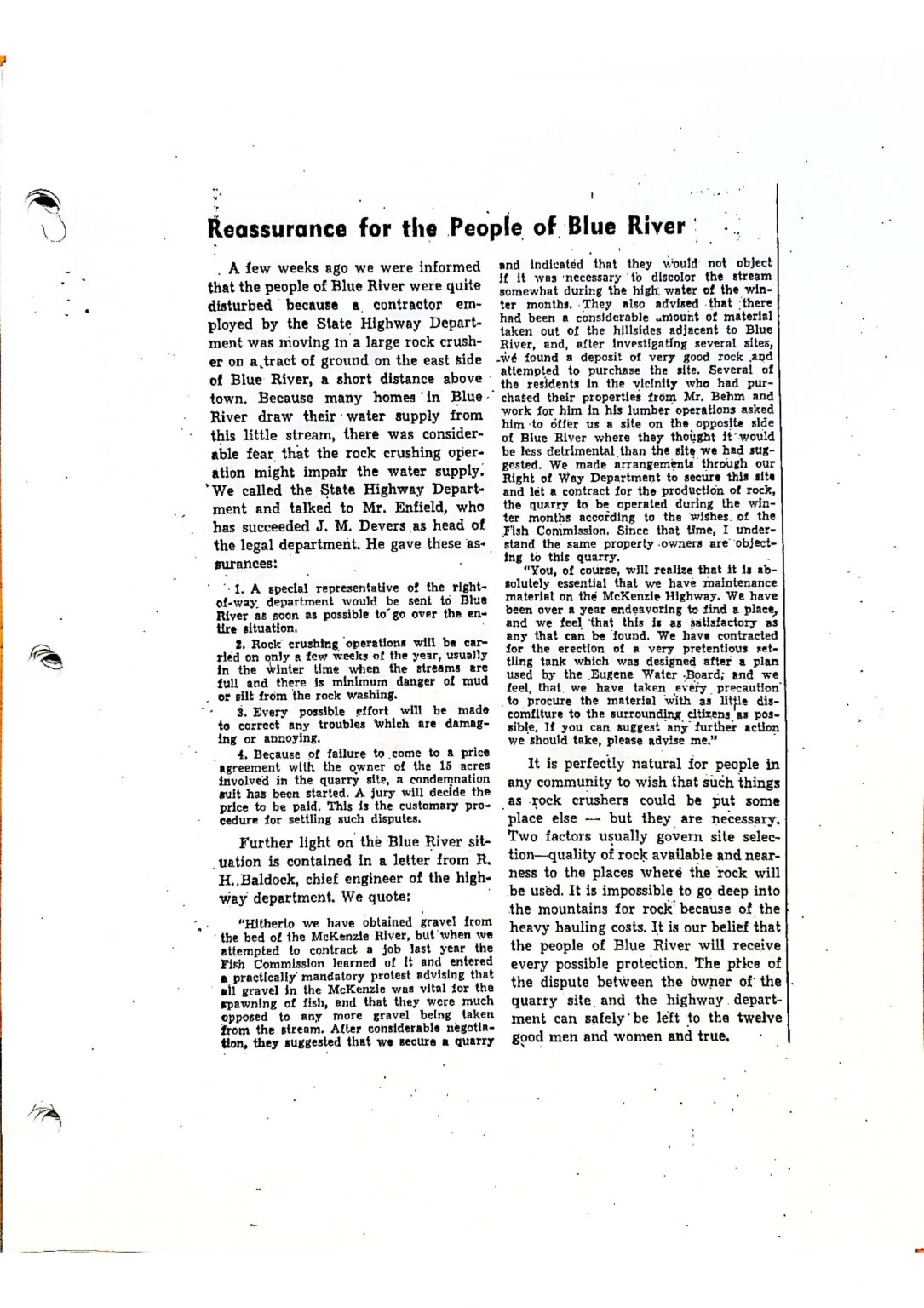
Blue River Park 1952 – 1997
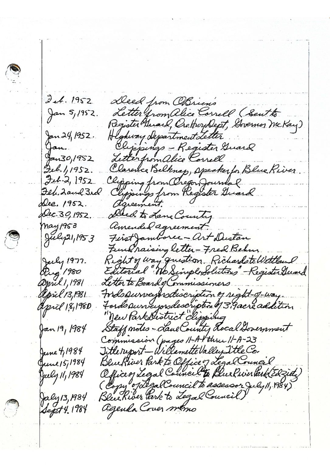
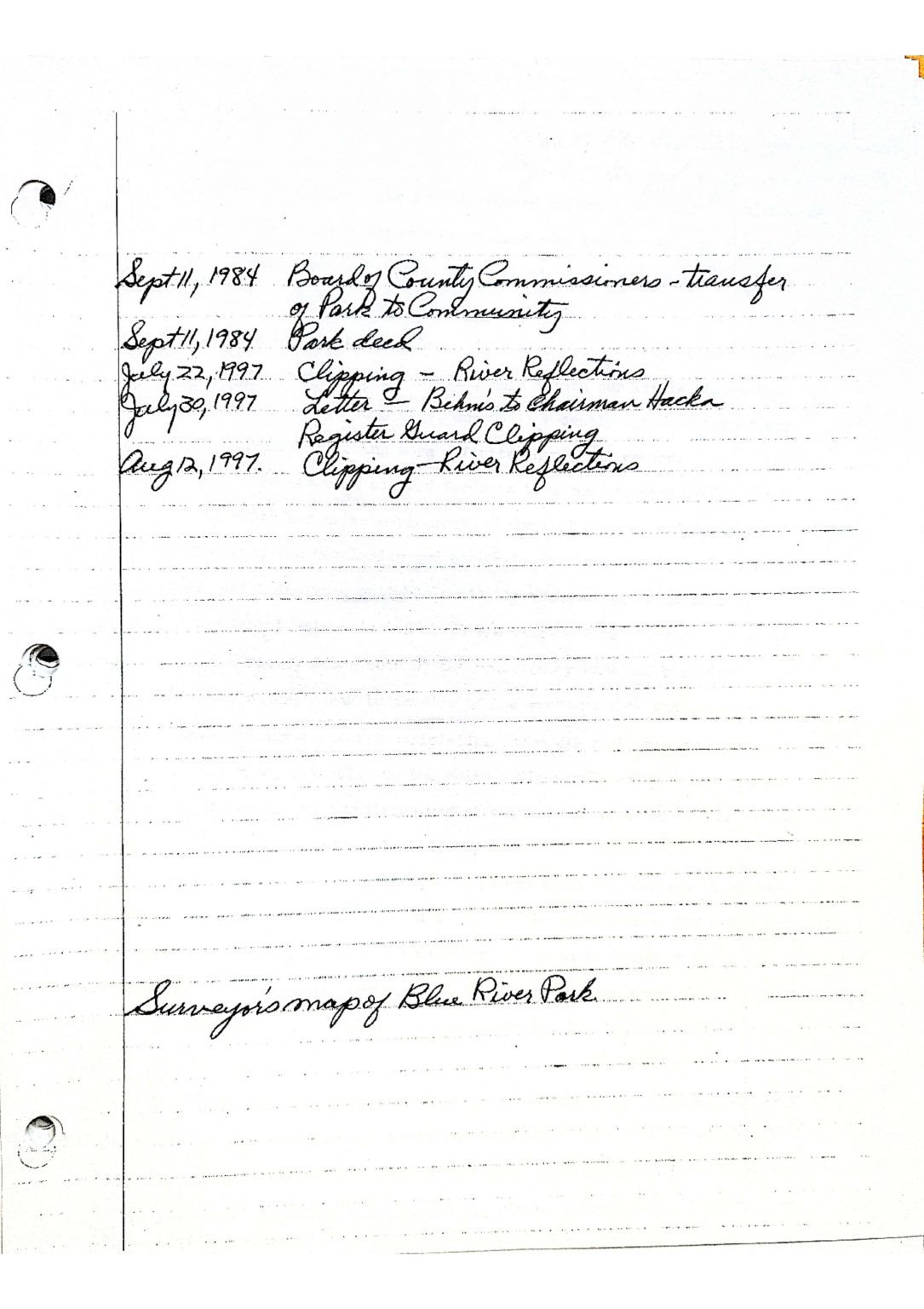
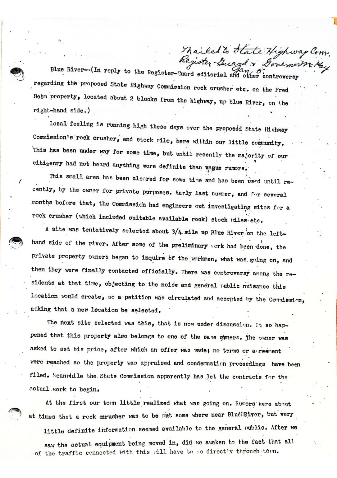
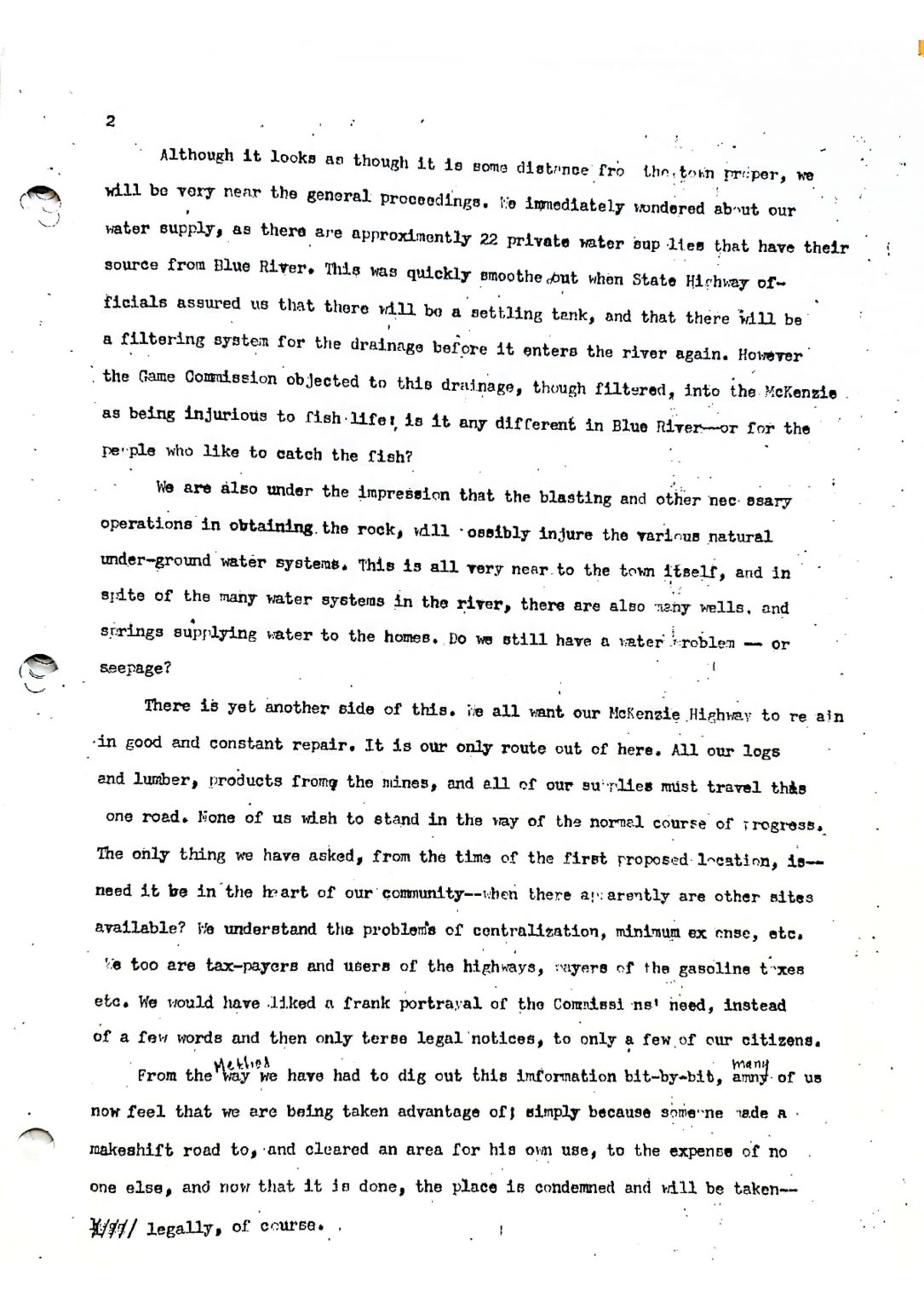
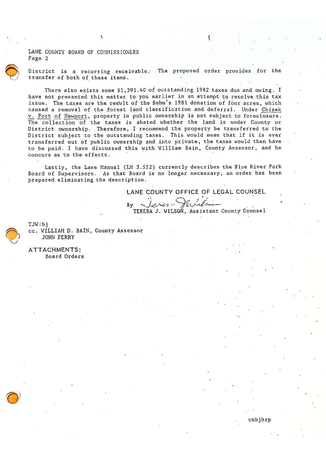
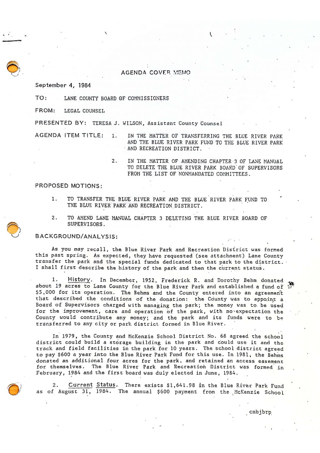
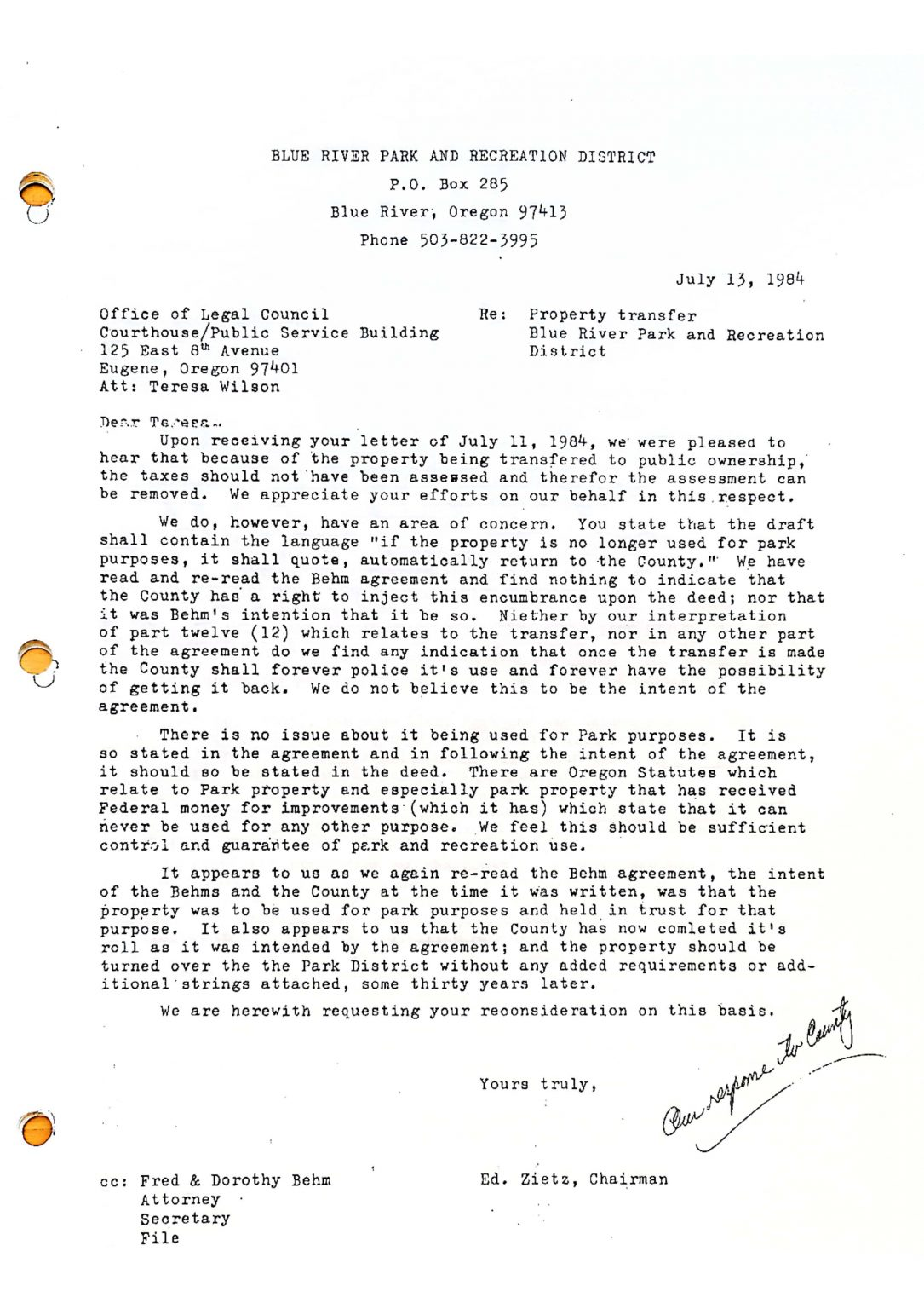
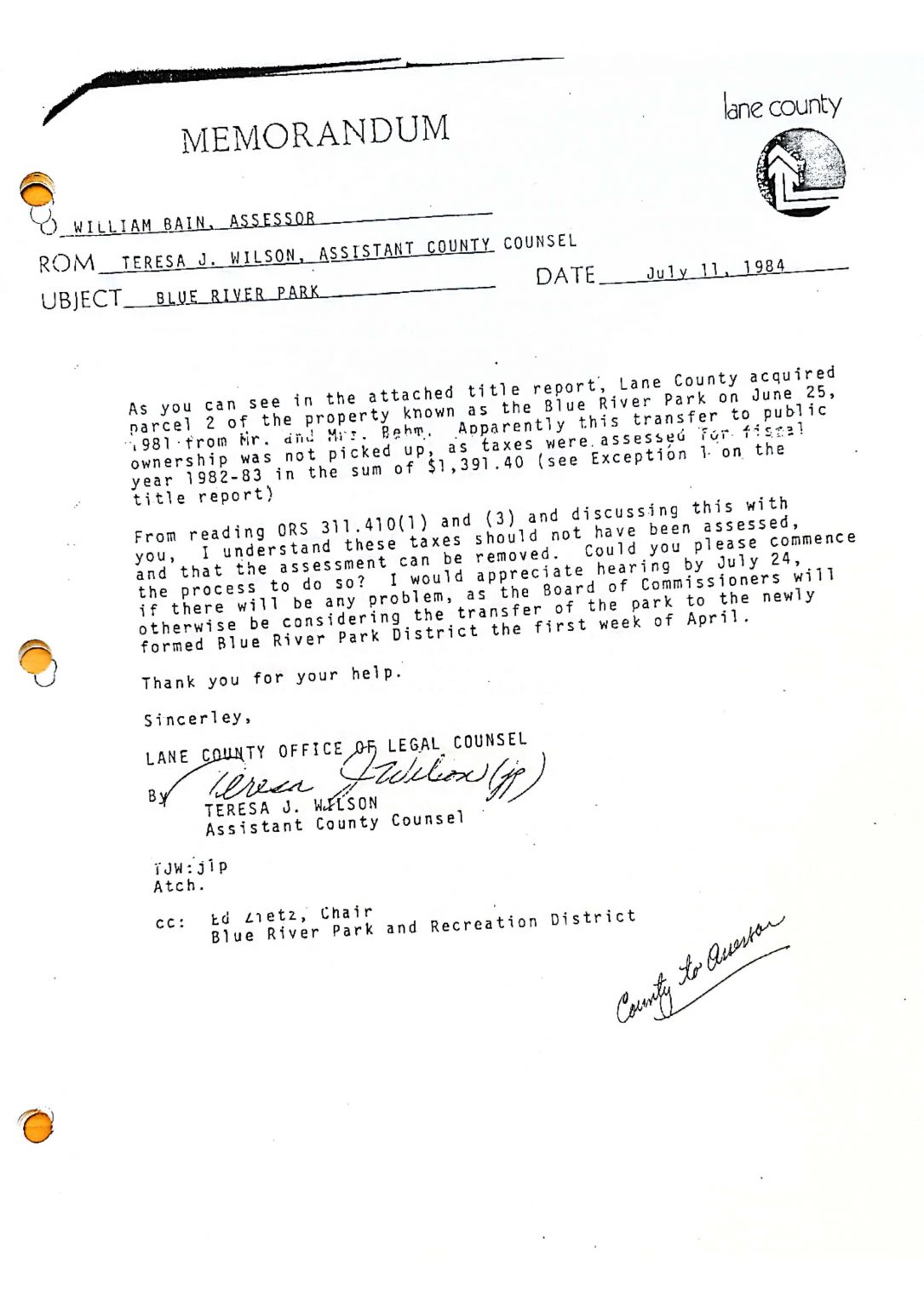
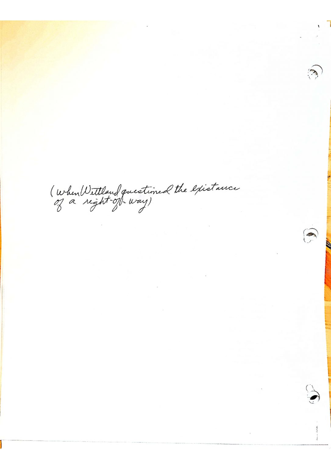
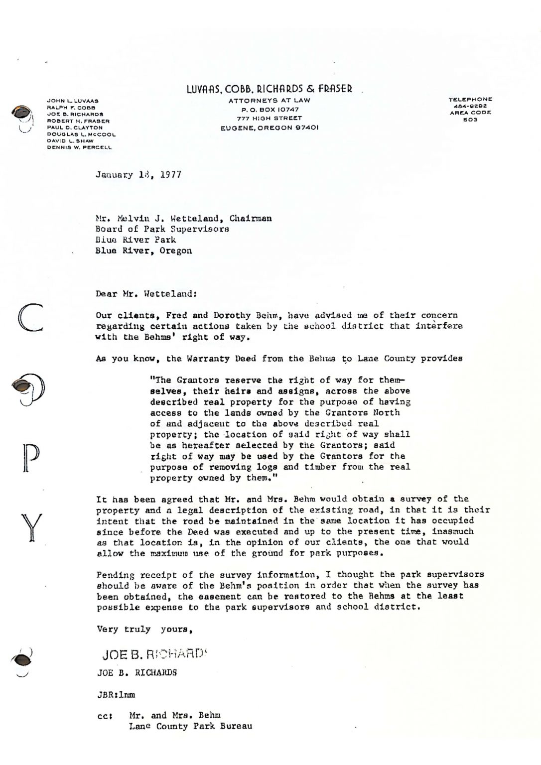
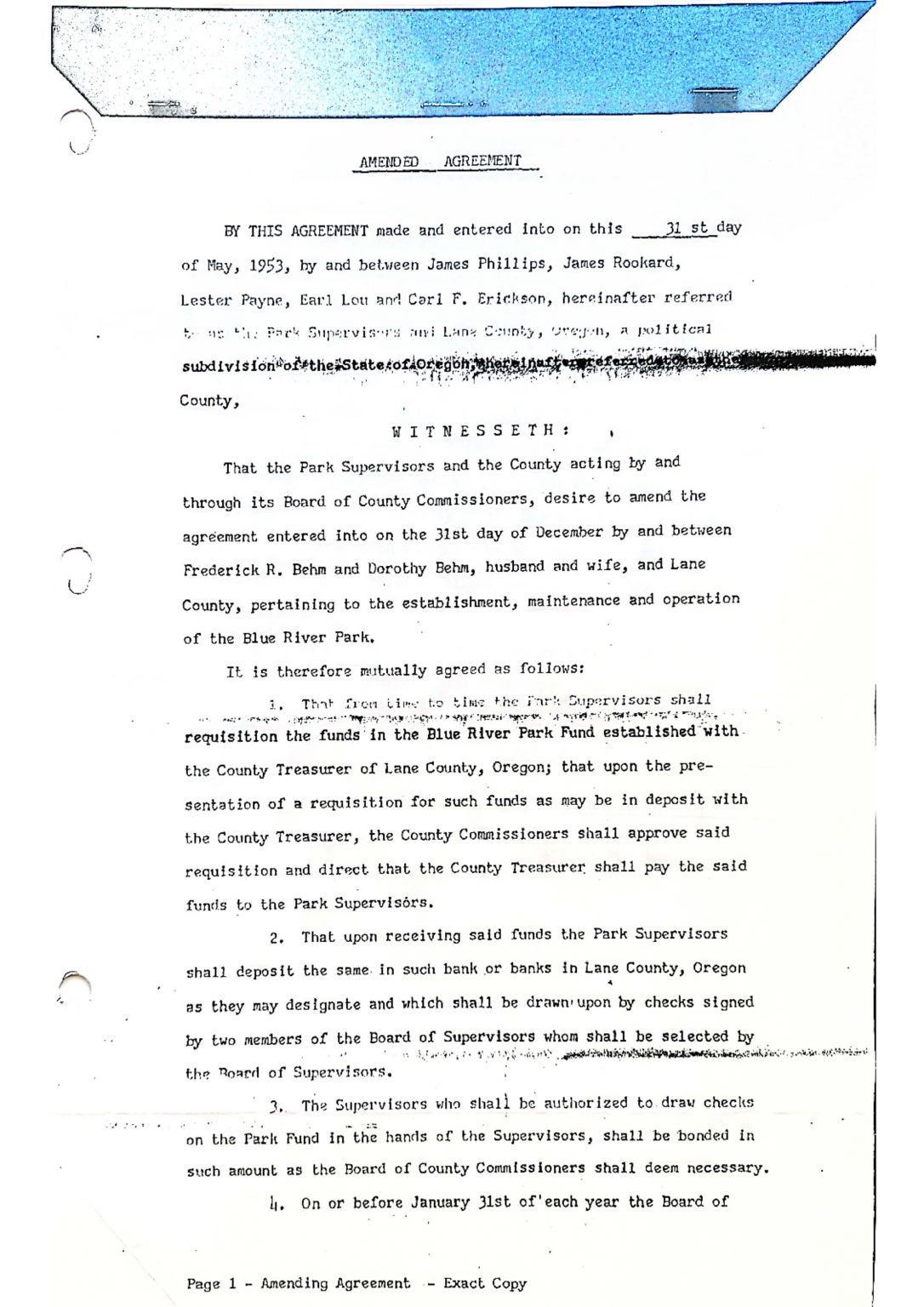
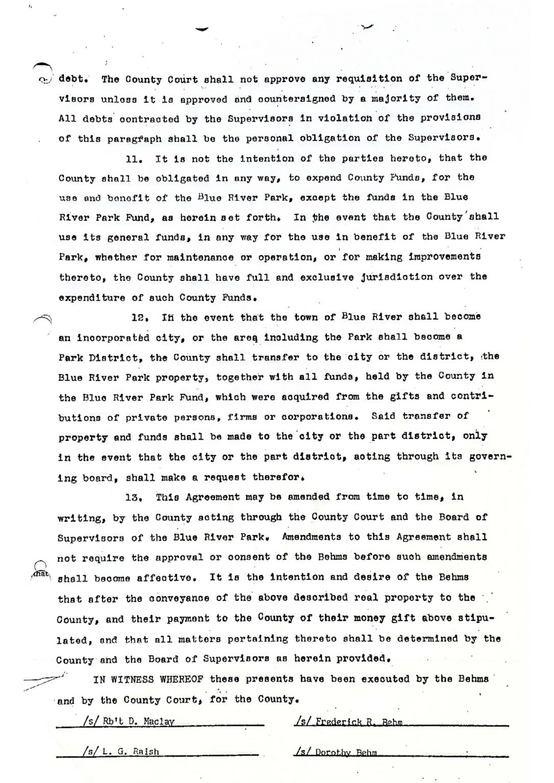
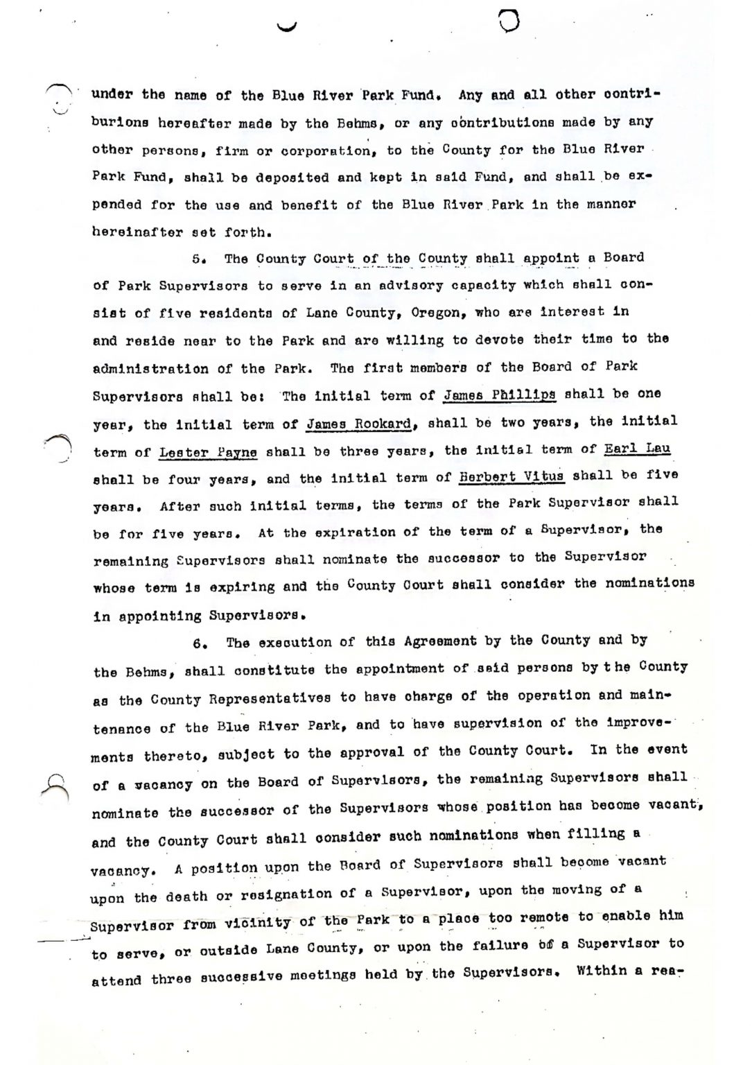
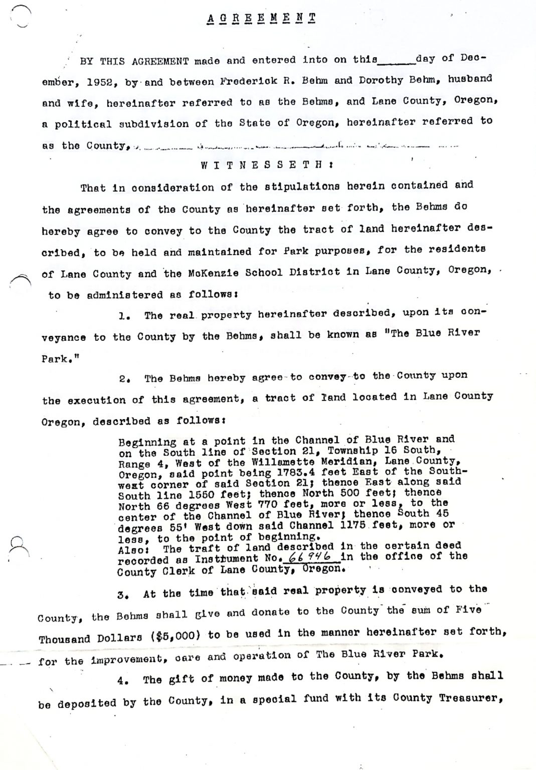
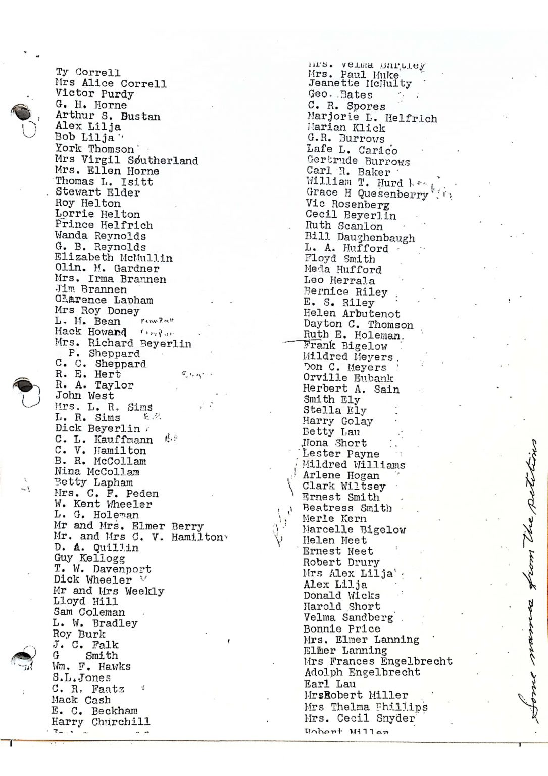
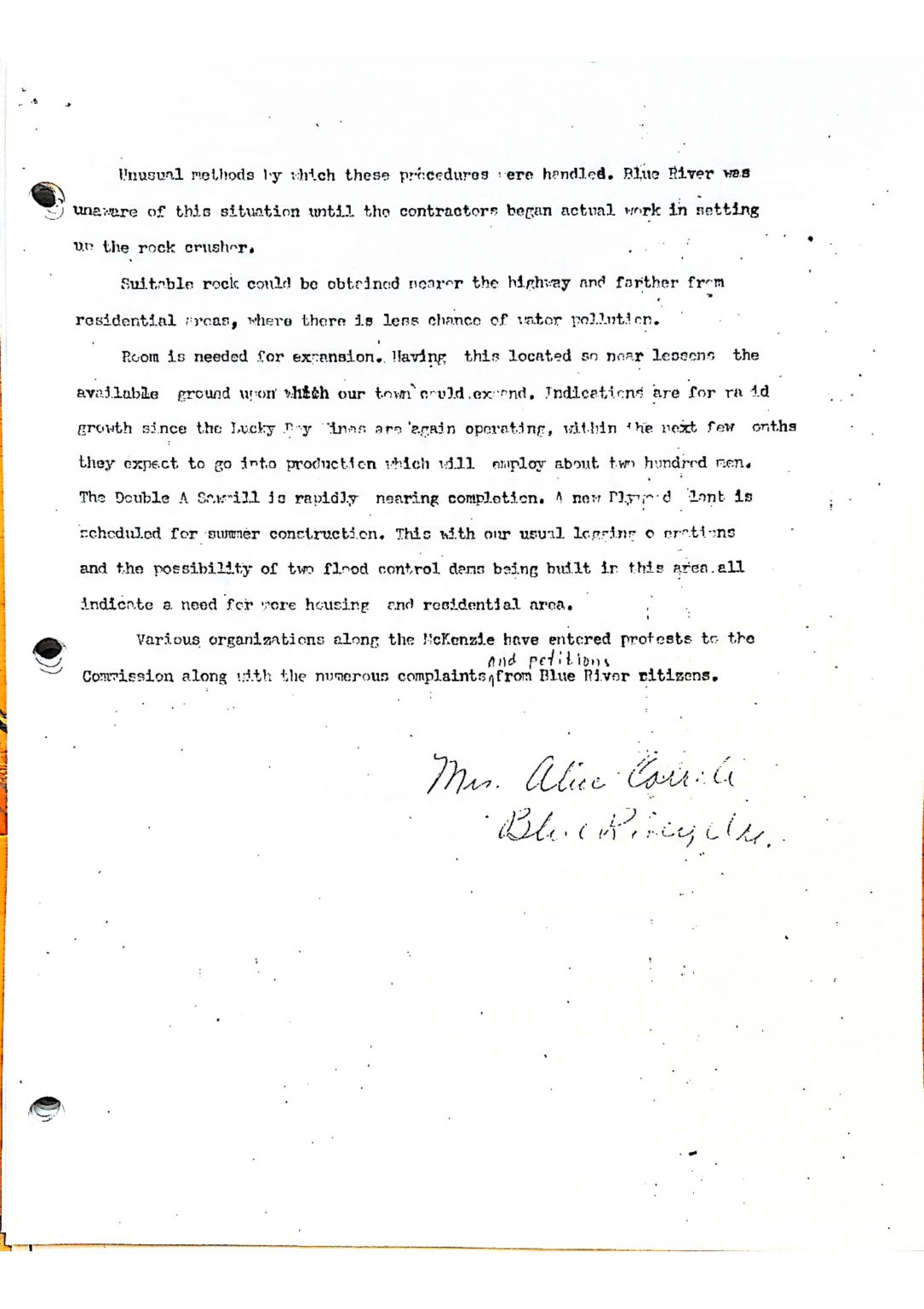
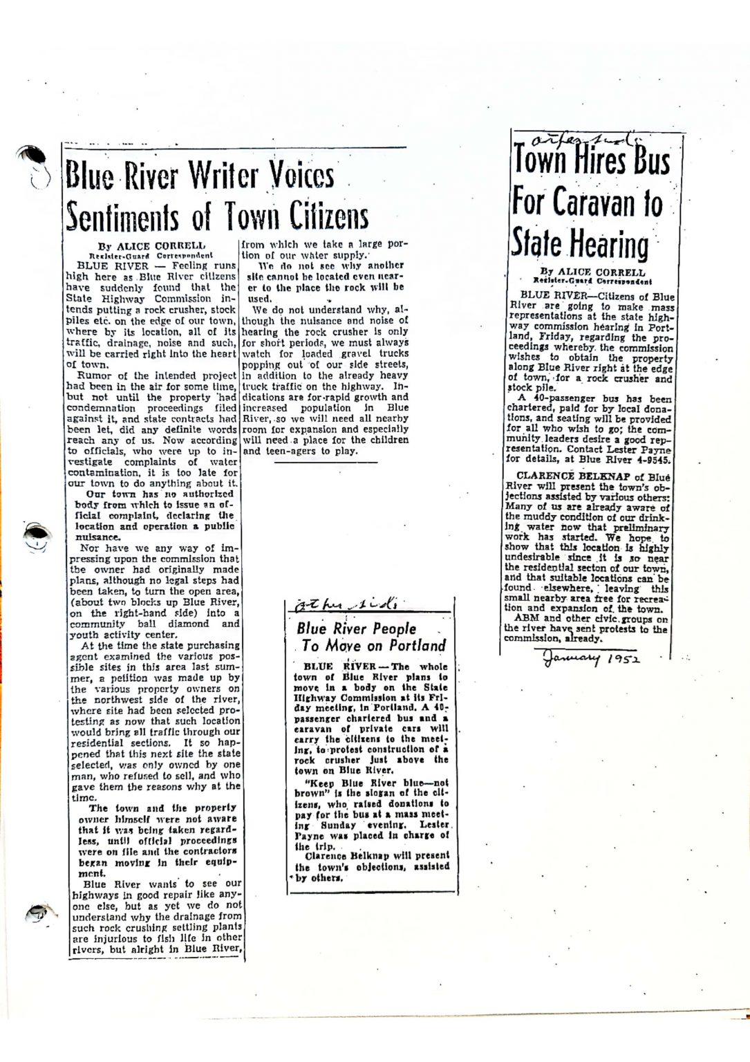
This is a series of historical news clippings and official documents covering 45 years of the Park’s history, compiled by Dorothy Behm. Use the arrows on the Left & Right to navigate through the document or select a specific page via the carousel at the bottom. There are 90+ pages.